 |
INTERNATIONAL
SOCIETY FOR PHOTOGRAMMETRY AND REMOTE SENSING INTERNATIONALE GESELLSCHAFT FÜR PHOTOGRAMMETRIE UND FERNERKUNDUNG SOCIÉTÉ INTERNATIONALE DE PHOTOGRAMMÉTRIE ET DE TÉLÉDÉTECTION |
São José dos Campos, October
18th, 2002.
Report
on the ISPRS Commission VI Mid Term Symposium
“New Approaches for Education and Communication”
Tania
Maria Sausen1
João
Ávila2
ISPRS
Commission VI President (1)
ISPRS
Commission VI Secretary (2)
Instituto Nacional de Pesquisas
Espaciais - INPE
CEP/Atividade de Treinamento
e Difusão de Conhecimentos em C&T Espacial
Avenida dos Astronautas, 1758
– Jardim da Granja
12227-010 - São José dos Campos,
SP – Brazil
Tel.
+55 12 3945.6862
Fax:
+55 12 3945.6870
Email:
tania@ltid.inpe.br, avila@ltid.inpe.br
1.
INTRODUCTION
The ISPRS Commission VI Mid Term Symposium “New Approaches for Education
and Communication” held at the National Institute for Space Research (INPE),
São José dos Campos, São Paulo State, Brazil, on September 16-18, 2002, was
organized by the ISPRS Commission VI, the Brazilian Society of Cartography,
Geodesy, Photogrammetry and Remote Sensing (SBC), the National Institute for
Space Research (INPE) and the São José dos Campos Municipality.
This
symposium was attended by 68 participants from 14 countries and four continents:
-American
participants: Argentina (1), Bolivia (1), Brazil (51), French Guiana (1),
United States (2).
-Asian
participants: Thailand (1).
-European
participants: Austria (1), England (1), France (1), Germany (4), Italy (1),
Turkey (1),Switzerland (1).
-Oceanic
participants: Australia (1).
The
decisive financial support received from the National Institute for Space
Research - INPE, the China-Brazil Earth Resources Satellite - CBERS, the Conselho
Nacional de Desenvolvimento Científico e Tecnológico - CNPq, the Coordenação
de Aperfeiçoamento de Pessoal de Nível Superior - CAPES and the Fundação de
Amparo à Pesquisa do Estado de São Paulo - FAPESP enabled the symposium, as
well other institutions that provided similar financial support to some participants.
The
main topics of the Symposium were:
·
Education and Training
·
Computer Assisted Teaching
·
International Cooperation and
Technology Transfer
·
Internet Resources and Distance
Learning
The
Symposium Scientific Committee composed by representatives of 14 countries
analyzed the papers submitted and made several critical and constructive proposals
regarding content, form and structure of the symposium as well helped to set
the symposium technical program.
The
70 authors of the 45 published papers represented 18 countries from 5 continents
and the content of these papers focused on Satellite Programmes in Latin America,
Geomatics Curricula and Education, Computer Assisted Transformation of Learning,
International Cooperation and Transfer of Technology, Internet Resources and
Distance Learning, Geomatics Education Programmes, Training Programmes Developed
by International Institutions, Practical Examples of Computer Assisted Learning
and Teaching, Web Based on Computer Assisted Learning and Teaching and Education
for Young Students and School Teachers.
2.
OPENING SESSION
The
symposium was officially opened on September 16th, 2002 by the
President of ISPRS Commission 6, Dr. Tania Maria Sausen who welcomed the participants
and expressed her appreciation for their attendance and the support she has gotten from
INPE, SBC, the São José dos Campos
Municipality, and the main financial institutions.
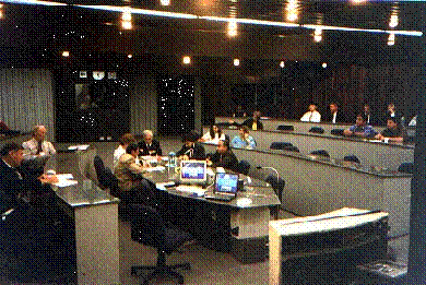
|
|
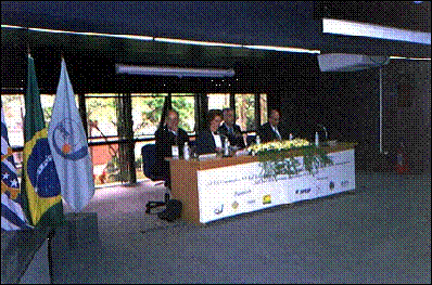
The
opening ceremony.
(From
left to right: Eng. Camillo J. M.Gomes, Dr. Tania M. Sausen, Dr. John Trinder,
Dr. Luiz Carlos M. Miranda)
The
ISPRS President, Dr. John Trinder, kindly spoke in Portuguese and English,
welcomed all participants and gave a general overview about the ISPRS activities
and the importance of Commission VI activities. He expressed as well his appreciation
about the symposium organization.
|
|
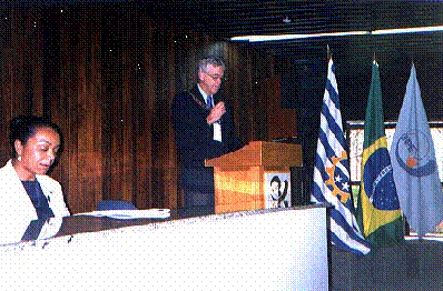
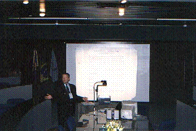
The
speech of Dr. John Trinder, the president of ISPRS, in the opening ceremony.
The
Director of the National Institute for Space Research, Dr. Luiz Carlos Moura
Miranda, and the President of the Brazilian Society of Cartography, Geodesy,
Photogrammetry and Remote Sensing (SBC), Eng. Camillo José Martins Gomes,
both have welcomed the participants and they expressed their pride in supporting
this symposium here in Brazil.
As
part of the opening session, a presentation
about the UN-Regional Centre for Space Science and Technology Education for
Latin America and the Caribbean - CRECTEALC was held by its General
Secretary, Dr. José Marques da Costa.
A general history and overview of this Centre as well
the main goals was shown as the development of skills and knowledge
of university educators and research and applications scientists, through
rigorous theory, research, applications, field exercises, and pilot projects
in those aspects of space science and technology that can enhance social and
economic development in each country; initial programmes shall focus on: remote
sensing and geographic information systems, meteorological satellite applications,
satellite communications and global-positioning systems atmospheric sciences
and the main programs in Brasil and Mexico Campus.
3. TECHNICAL PRESENTATIONS
The 32 presented
papers from 73 authors in 14 countries were arranged into seven technical
sessions, three special sessions, a poster session, a mini course and a forum.
Some program changes
were necessary due to absence of some authors. The Technical Session 4 was
cancelled because most of the authors did not come to present their papers.
For this reason the Technical Session 5 was anticipated and a visit to INPE
Visiting Center, the local host, was made after this session. Presentation
time was enough to point out the main topics of each paper, with an open discussion
at the end of each presentation.
These presentations
brought valuable and detailed information regarding to the main topics of
this symposium. More details can be found in the full papers, which are available
in the proceedings and on the WEB at http://www.commission6.isprs.org.
The proceedings
of the symposium include most of the papers. Seven authors, after the papers
selection, have cancelled previously their participation in the symposium,
due to personal and financial issues. Besides this, eight additional authors,
in the last moment, have requested the possibility to present a paper in the
symposium or the Symposium Coordinator invited them. These eight papers were
presented in replacement of the seven authors who have not attended the meeting.
The papers were
published as International Archives of Photogrammetry, Remote Sensing and
Spatial Information Sciences, Vol. 34, Part 6 and consist of 181 pages. They
can be ordered from GITC bv, P.O. Box 112, 8530 AC Lemmer, The Netherlands,
tel. +31 514 561854, fax +31 514 563898, e-mail: mailbox@gitc.nl,
http://www.gitc.nl. The proceedings were also distributed on a CD.
4. PAPERS COMMENTS BY CHAIR AND CO-CHAIR OF TECHNICAL PRESENTATIONS
Special Session 1:
Satellite Programmes in Latin America
Chair:
Ian Dowman
Co-chair: Leonel Fernando
Perondi
- The China-Brazil Earth Resources
Satellite – CBERS
Presented
by: José Raimundo Braga Coelho
INPE/MECB, Brasil
Comments:
The CBERS program
is an example of successful international cooperation in the space area with
important results for the Remote Sensing area. Such international cooperation
should be highly encouraged. It would be highly desirable that the cooperation
in the Application Segment of the program be strengthened. The initiatives
regarding the continuity of the program with CBERS 3&4, a family of satellites
which will make available higher resolution images, are very much welcome.
- The
Dissemination of CBERS Images to Universities in Brazil: Procedures and Results
Presented
by: Paulo Roberto Martini
INPE, Brasil
Comments:
Data
provided by the CBERS program adds to the databases about the Brazilian territory,
contributing to an improved monitoring and assessment of changes in Brazilian
natural resources. There is the necessity of defining a policy for the distribution
of CBERS images.
Chair: Jana Niederoest
Co-chair: Tania Maria Sausen
- Recent Global Changes in Geomatics
Education
Presented by: Gottfried Konecny
University of Hannover, Germany
Comments:
The
approach of this presentation was on Geomatics and Geomatics Education in
general and in a global way. Some topics on topographic imaging, Geomatics
concepts and Education in Geomatics historical were also presented as well
as a list of countries where it can be found Geomatics courses. During this
presentation a view of the Geomatics teaching and profession in the world
and the job market was shown.
- Remote Sensing Education Programmes for a new University
in French Guiana
Presented by: Laurent Polidori
ORSTOM, French Guiana
Comments:
This
paper discusses on a Remote Sensing Education proposal in French Guiana. The
program has been developing in a small
University in French Guiana, Guadeloupe and Martinique. It was presented the
reasons to set this course, and an Education curriculum was proposed in agreement
with the characteristics of the area.
- Remote Sensing in Different Education Levels: A Case Study
Presented by: Sandra
Maria Fonseca da Costa
Universidade do Vale do Paraíba, Brasil
Comments:
The
lecturer has presented her experience using Education in Remote Sensing in
the Geography Graduation Course in different levels at the Universidade do
Vale do Paraíba in São José dos Campos, Brazil. Some examples of the using
of Remote Sensing in Geography’s students monographs, developing projects
of educational material for fundamental and high level students were also
presented.
Technical Session 2: Computer
Assisted Transformation of Learning
Chair:
Pierre Grussenmeyer
Co-chair:
Hans-Peter Bähr
- Remote Sensing Education CD-ROM: an Interactive Approach
to Technology Transfer Utilizing Real Research Results
Presented
by: Nelson Wellausen Dias
Indiana
State University, United States
Comments:
The
lecturer has presented a Brazilian version of a CD from United States, displayed
of CD (3) contents, examples of “multiple choice” and statistics database
(available for Professor). Also there was a discussion on the availability
of this for ISPRS, other activities and products from other sides as NASA,
for instance. Two questions to debate: What does it mean learning? Contact
to teachers in schools?
- Didactic and Methodological Challenges
in New Media Based Teaching and Learning for GIS
Presented
by: Florian Bischoff
University
of Karlsruhe, Germany
Comments:
He
has presented a theory of learning: “As the teacher, the learner is responsible
for the success”. Animation “laser scanning”. The discussion was on games
to children (motivation).
Poster Session
- Urban Imagery Combining Photogrammetric
and Remote Sensing Techniques: a New Training Course at ENSAIS Strasbourg
Presented
by: Pierre Grussenmeyer
ENSAIS-MAP, France
This
poster was presented by the author and was available for discussion in the
hall during all symposium period.
- Training New Talents in Space Science
and Technology: INPE at School
Presented
by: Tania Maria Sausen
INPE,
Brasil
This
paper was presented by the students from the grammar and high schools that
took part in the project.
|
|
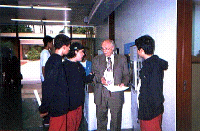
The
Brazilian grammar and high school students showing their experience in the
project to Dr. Gottfried Konecny, from University of Hannover, Germany.
Mini Course SPRING
Chair: Gilberto Câmara Neto
Co-chair: Alexandre Benevento
Marques
- The Brazilian Experience Towards
Integrating GIS and Remote Sensing
Presented by: Antônio Miguel
Vieira Monteiro
INPE,
Brasil
Comments:
The
main topics presented were: historical context on “Appropriate Technology”
for developing countries, ways of representing (digital environment) the geographical
space, an evaluation of Image Processing Division/INPE for the development
of SPRING and TerraLib, the obstacles for the development of Brazilian Technology
in a global economy. Main discussions in audience: Brazil is a partially developing
country and a partially developed country? The 25.000 SPRING users represent
a remarkable fact.
- Training in the use of SPRING–GIS:
Experience in Latin America and the Caribbean Region, Africa and Asia
Presented by: Eduardo Manuel
Banús
IAI,
Brasil
Comments:
The
main topics presented were: 15 American countries involved with an IAI project
and other Institutions, and the use of the SPRING Program as platform to GIS.
The demand for training courses in this program by the involved countries
was bigger than planned in the beginning
of the project besides countries in other continents as Africa and Asia interested
in taking part of it.
|
|
The presentation “Training in the use of SPRING–GIS: Experience in Latin
America and the Caribbean Region, Africa and Asia” by Eduardo Manuel Banús,
from the Inter-American Institute for Global Changes – IAI, Brasil
- SPRING software: Tools and Applications
Presented
by: Silvana Amaral Kampel
INPE,
Brasil
Comments:
The
main topics presented were: a conceptual introduction of the SPRING Geoprocessing
Program, v.3.6, followed by a 10 minutes presentation of this program. It
was discussed in audience the capacity of SPRING to geocode and it is confirmed
it. A UN representative affirmed that this program has improved a lot since
the last training course organized by DPI and UN in 1997.
- New Approach on Teaching Geotechnology
Presented
by: Hilcéa Santos Ferreira
INPE, Brasil
Comments:
The
main topics presented were: E-learning – Internet training course, a presentation
of the TelEduc tool to use E-learning, a prototype project on Introduction
to the Geoprocessing has been developing.
Technical Session 3: International Cooperation and
Transfer of Technology
Chair: Luis Alberto Murgio
Co-chair: Eduardo Manuel Banús
- Joint Educational Geomatic
Programmes in Brazil and Germany since 1981 Strategies for Sustainable Development
Presented
by: Hans-Peter Bähr
University
of Karlsruhe, Germany
Comments:
The
projects implemented between Brazil and Germany was summarized during the
presentation. Special remarks were focused on: sustainable education in long
term, the role of the political support (formal agreement), joint teaching
and research, interaction (Institutions, scientists and teachers), languages.
Conclusion: 20 years of bilateral cooperation, 20 PhD in Geodetic, quick success
should not be expected.
- A Virtual Receiving Station for
Remote Sensing Users in the Caribbean-Amazonian Area
Presented
by: Laurent Polidori
ORSTOM,
French Guiana
Comments:
The
use of a local implemented ground station for the reception of NOAA AVHRR
and Sea Wifs in Cayenne was described. Using this initiative a network called
ECOLAB (Cayenne/Belém/Macapá) was implemented using internet facilities with
free access.
- Photogrammetry
and Remote Sensing Training for Cadastral Staff in Central America
Presented by: Laurent Polidori
FIEF-SOFRECO,
French Guiana
Comments:
Since
that Central America consider “Land Administration” as a priority of six governments
of this area, they are looking for training in photogrammetry and remote sensing
for cadastral purpose. During the presentation different approaches to solve
the problem were described. In order to have an idea of the volume of business
involved, the government of Guatemala received US$ 100,000,000.00 for cadastral/register
modernization – the World Bank, USAID and some European governments are related.
- Decentralization Policy of ITC in
Latin America
Presented by: Carlos
Valenzuela
ITC,
Bolivia
Comments:
The
speaker presented the new regional strategies of the ITC from The Netherlands.
During the presentation a resume of different activities were done, like remarks
more than 14.000 students and 160 meetings from 1950 to 2000. Finally ITC
is trying to send Dutch specialist to South America in order to install new
associated center.
Technical
Session 4 – Internet Resources and Distance Learning
The Technical Session 4 was
cancelled because most of the authors did not attend the meeting.
For this reason the Technical Session 5 was
anticipated and a visit to the INPE Visiting Centre was made after this session.
Technical
Session 5 - Geomatics Education Programmes
Chair: Lawrence W. Fritz
Co-chair: José Carlos Neves Epiphânio
- Remote Sensing and GIS Activities
in Asian Institute of Technology: Education, Training and Research
Presented
by: Kiyoshi Honda
AIT,
Thailand
Comments:
Dr. Honda presented
the activities of the Asian Institute of Technology (AIT). AIT is an international
graduate institution of higher learning with a mission to develop highly qualified
and committed professionals who will play a leading role in the sustainable
development of the region and its integration into the global economy. One
of its centers is the School of Advanced Technologies, which has a Space Technology
Applications and Research (STAR) branch. STAR program is composed of three
main units including STAR academics for teaching, ACRoRS (Asian Center for
Research on Remote Sensing) for research, and GAC (GIS Application Center)
for training. People could have a very overview of the activities, projects,
and products carried out in the AIT.
- Evolution of Teaching of
Remote Sensing, a Geoprocessing and Geomatic in the Federal University of
Santa Maria, RS.
Rudiney Soares Pereira/ Presented
by: Tania Maria Sausen
Universidade
Federal de Santa Maria, Brazil
Comments:
Dr.
Sausen made the presentation instead of Dr. Rudiney, because he has to leave
unexpectedly the symposium due personal issues. It was shown the main history
of the Graduate Program in Geomatics at the University of Santa Maria. One
of the concentration areas is Remote Sensing, which has five main research
lines. The program can be accomplished in three levels: specialization, master
and doctor.
- EU Research and Education Programmes
for non-EU Countries
Presented
by: Jana Niederoest
Swiss
Federal Institute of Technology - ETH, Switzerland
Comments:
Dr.
Niederoest presented the efforts of the European Union towards the research
and education for non-EU countries in the field of Geomatics. It was shown
that there are various programs in this direction. The framework programs
are planned for four years. Each particular program is specific to a target
group of non-EU countries. The possibilities for participating were explained,
including the kinds of cooperation, application and evaluation procedures,
and organizational and financial aspects. It was shown that there are broad
opportunities for developing countries to participate in the programs. It
was stressed that cooperation is a prerequisite for applications
- UNESP Graduate
Program on Cartographic Sciences
Presented by: Antonio Maria Garcia Tommaselli
UNESP/Presidente
Prudente, Brasil
Comments:
Dr.
Tommaselli presented the University of São Paulo State, its various campi, and in particular, the Presidente
Prudente campus, which held the
Cartographic Sciences Program. The program encompasses several Geomatic fields,
including GIS, Geodetic positioning and Image Computing. The structure of
the Program, the infrastructure available, the research projects being carried
out and the perspectives for the near future were presented.
Chair:
John Trinder, ISPRS President - Australia
Co-chair:
Tania Maria Sausen, Commission 6 President - Brazil
Comments:
Dr.
Trinder opened the forum and presented the main topics discussed, as follows:
- Redefinitions
of Technical Commissions (TCs);
- Presentation
of the current 7 TCs titles;
- A
brief of TCs role (emphasized professional aspects);
- A
brief of Remote Sensing history, some bibliography;
- Highlighted
the TCs structural problems (Inoverlapping between areas of TC 2 and several
other TCs, ISPRS is seen by many as primarily a photogrammetry society, the
status of ISPRS should be improved in Remote Sensing, ISPRS does not attract
people can innovate);
Issues
to be considered:
- Is
it adequate for the next 20 years?
- Redefine
or not?
- What
changes should be made?
- What
is the basis of new structure?
- How
to improve the ISPRS recognition in Remote Sensing by redefining TCs?
Dr.
Sausen questioned the reason of no mention to TC 6. She is sure that TC 6
needs to improve in many aspects. Changes could be started by the name of
the TC6. Nobody knows what means “Communication”. She suggests the word “Dissemination”
instead. She stressed the importance of having a better interaction among
TCs and suggested Joint Seminar to disseminate the subjects and activities
among them. This occurs in many other similar societies as part of a special
session.
Another
way of disseminating the ISPRS activities is to present it to Universities,
in a Remote Sensing Congress (small session about RS and GIS).
RS
is relatively new compared to the photogrammetry area; we are facing a kind
of transition. Dr. Dowman showed that this process is different between developing
and developed countries.
So,
how to enhance these activities in developing countries?
Dr.
Sausen said that the answer to this is to disseminate them in graduation courses,
to convince people, mainly teachers to teach classes about it (in Brazil)
and young students that RS is important, though difficult, gradual task, and
through lectures in RS Symposium (one or two days seminar, it is more effective
and it works!).
She
said this could be done for example in November in the SELPER meeting in Bolivia.
Thus, people all over the world can bring some innovation.
Dr.
Konecny commented that it is not necessary to invest much money to reach good
results and mentioned that in India the scientific community could motivate
people to use it through these short seminars.
Dr.
Sausen reminded all with optimism the importance of the UN Regional Center
for Education to example of ITC in Bolivia as being a good center for the
dissemination of these activities. Dr. Sausen also commented that the language
(English) has been a real obstacle in the meetings in not English speaking
countries. She has suggested meetings in double language, as has held in the
TCVI WG 1 and 3 in the Brazilian Cartography Congress in Porto Alegre, Brazil.
In this seminar most of the presentations were done in Portuguese or Spanish,
and the transparences and power point files were written in English. The doubled
language would be highly appreciated in the next meetings.
Dr.
Trinder commented his successful experience in a Seminar with simultaneous
translation. Another way, it could be preparing transparences in English or
other language and the oral presentation be in Portuguese or Spanish. He also
mentioned the Seminar in Porto Alegre.
Dr.
Haubold from UN enthusiastically invited ISPRS to cooperate with UN in order
to solve some of its problems. He showed the possibility of co-organizing
meetings until 10 in a year if it is necessary. Dr. Haubold proposed to talk
to Dr. Trinder more details about this cooperation at the same time that mentioned
the UN cooperation with several Space Agencies to provide the organization
of meetings and speakers.
In
addition, Dr. Konecny agreed with Dr. Sausen that there should be more Joint
Meetings in Latin America.
Dr.
Sausen said that she could invite Dr. Costa from the Universidade do Vale
do Paraíba to present about three lectures in a Special Session in Education
and Environment in a meeting in Cochabamba in November 11, 2002.
Dr.
Fritz is favorable to ISPRS to join efforts and Dr. Honda thinks that AIT
can cooperate with ISPRS.
Dr.
Sausen concluded emphasizing the importance of changing the title of TC 6
to Education and Dissemination and commented the importance of the experience
of Dr. Erling to teach Cartography to children. She added that this kind of
activities could be provided to children and young students in a Shopping
Center for instance, showing them the importance of Space Area in order to
motivate them during a week. This could be done in several cities or in an
International Congress.
After that, Dr. Trinder closed the forum.
Co-chair:
Tania Maria Sausen
- Education Curricula in Space Science
and Technology
Presented
by: Hans Joachim Haubold
UN,
Austria
Comments:
This
presentation was on a general view about the OOSA activities in Education
area: RS, meteorological satellites, communication satellites, Space Science
and Atmosphere. An explanation was given on workshops dynamic and how they
are organized in different countries like the workshops in astronomy. It was
also described how these workshops can be organized in developing countries
and the educational material. It was shown the Centers program and the current
situation of each one in relation to the basic curricula. At the end, the
speaker has distributed the basic curricula to the participants.
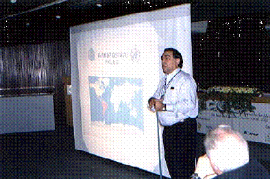
|
|
The
presentation Education Curricula in Space Science and Technology by
Dr. Hans Haubold, from UN, Austria.
- The Education and Training
Programme of the European Space Agency to bring space to citizens, decision
makers and professionals
Presented
by: Juerg Lichtenegger
ESA/ESRIN,
Italy
Comments:
An
introduction about ESA and its activities was made as well the Centers and
developed. Satellites. A general view of the ESA Education and Training activities,
how to access these activities and courses was shown as well a presentation
of the EDUSPACE project dedicated to high school students, and some case studies.
The educational material for this program was also shown and its dissemination
to the Latin America.
Technical Session 6: Practical Examples of Computer Assisted
Learning and Teaching
Chair: Walter
Humberto Subiza Piña
Co-chair: João Ávila
- The E-FOTO Project: An Educational
Digital Photogrammetric Workstation
Presented by: Luiz Carlos
T. Coelho Filho
Instituto
Militar de Engenharia, Brasil
Comments:
The
speaker presented the Military Institute of Engineering (IME) in Brazil, its
history and courses. He presented the use of Photogrammetry in Cartography
and the difficulties of the IME to get the plotters. Digital Photogrammetry
depends on 3 elements: people, programming in Portuguese and knowledge. IME
resources are limited and the objective of this project is to develop digital
photogrammetry software as part of an educational package. The most difficult
challenge is the students understand the photogrammetry language. The programming
language is C++ and self-learning and previous knowledge are not required.
But close attentions to the routines/steps of this software are strongly recommended.
The end-user is the student that will be able to develop his own software.
This project has been tested for 4 years in digital photogrammetry students.
The website is http://e-foto.sourceforge.net.
Some demonstrations of this software/binaries were made and the configuration
of the camera was shown.
- Development of a GIS Supported Interactive
“Remote Sensing” Learning Module
Presented
by: Heike Weippert
University
of Stuttgart, Germany
Comments:
The
speaker presented the development of a GIS module of interactive learning
called GIMOLUS. It is a multidisciplinary module with several GIS exercises.
There are 8 Institutions involved with GIMOLUS. It was tested by German Universities
in the courses of Psychology in Education and approved by its excellent didactic.
Since 1998 about 1600 students have already used this learning module. The
speaker also showed the software platform for the students learning, its architecture
and the technology used. This package is accessible with 11 units and 31 learning
module. Modules are small with animation and specific text image.
There are courses as RS basic physics, sensors, integrated RS data
in GIS, applications in RS and exercises.
The
speaker demonstrated the electromagnetic spectrum where the student is able
to find a Landsat 7 Satellite band and associate it with the test site, combining
different bands. The exercises steps: band combination, digitized or screen,
polynomial attribution etc. At the end, the speaker added that e-learning
can be integrated to other computational technologies. This prototype allows
creating an integrated and interdisciplinary virtual environment during the
exercises. It is destined to master courses in developing countries, geographers
etc. The project phases can be assessed continuously and animates the student
to learn more and more. The website presented by the speaker was http://www.gimolus.de.
- A Educational CD-ROM on Remote Sensing
and Geoprocessing Techniques for Biologists
Presented
by: Marisa Dantas Bitencourt
Universidade
de São Paulo, Brasil
Comments:
The
speaker presented the difficulties of Biologists to learn Geoprocessing as
reason of the development this educational material through website. This
is an educational material in CD that motivates biologists to learn Geoprocessing
in their rhythm, in appropriate language and can be distributed to whole country.
It contains practical exercises, which enable students to use RS and solve
ecological problems. There are 4 research lines: conservation and sustainable
development, environmental Ecology, environmental epidemiology and basic research
on RS in Ecology. Main points in RS and Geoprocessing in Ecology:
- Land cover distribution and quality,
- Water bodies distribution,
- Human footprints left over vegetation,
- Topographic simulations,
- Compare natural and disturbed effects of human being actions.
Development
of a CD with 3 data series: an introductory text, examples in text and screen
and PDF files.
Discussion:
- Optimization of the process of learning,
- DEM – Simulate environmental conditions (Ex. indicate mosquitoes habitat
diversity)
Conclusion:
- Many examples can motivate students,
- Use of NDVI, map algebra and better use of satellite images in ecologic
studies.
The
speaker finished her presentation showing the website of the Universidade
de São Paulo, Remote Sensing and Geoprocessing in Ecology.
Technical Session 7: Web
based on Computer Assisted Learning and
Teaching
Chair:
Juerg Lichtenegger
Co-chair:
Tania Maria Sausen
- Arpenteur 3.0: Recent Development
in Web based Photogrammetry
Presented
by: Pierre Grussenmeyer
ENSAIS-MAP,
France
Comments:
The
speaker presented the evolution of Arpenteur project; current possibilities
and limits; the software synoptic outline; developments since 2000; advantages
and disadvantages; XML structure.
- ISPRS
and Internet: history, presence and future
Fabio
Remondino, Tuan-chih Chen / Presented by: Ian Dowman
ISPRS, Taiwan
Comments:
The
speaker outstand the following points during his presentation: a brief history
of the work; users and number of access to the web page; available web pages
of ISPRS TC; WG and members; ISPRS Event Calendar; Educational Resources and
opportunities.
- Training Brazilian Managers
on Geoprocessing and Orbital Image Interpretation for Coastal and Offshore
Reef Conservation
Presented
by: Douglas Gherardi
INPE,
Brasil
Comments:
The
objective of this training was to train professionals to use Remote Sensing
and GIS in order to make based reef maps. Some points were outstand as course
design and structure, information about tutorial, pilot research area, methodology
used to prepare maps, data results and integration, workshops.
Special Session 3: Education
for young students and school teachers
Chair: Orhan Altan
Co-chair:
Tania Maria Sausen
- Satellite Technology as part of
high school syllabus: an innovative educational proposal
Presented
by: Luis Alberto Murgio
Instituto
Universitário Aeronáutico, Argentina
Comments:
A view
of the uSat-2 satellite, the project objectives and how high school students
can use this satellite data was shown. Lecturers were given in high schools
and the success of this project motivated its continuity according to the
rules of MCE of Argentina. The speaker emphasized the use of small ground
station in high schools in order to receive satellite data directly and informed
the specialists who took part in this project.
- Cartographic Initiation for Young
Students, using Aerial Photographs and Satellite Images
Presented
by: Maria
do Carmo Silva Soares
INPE,
Brasil
Comments:
This
paper is about the Cartographic Initiation, which became a book for students
who need to use aerial photographs and satellite images. It was shown the
methodology of this work; the chapters of this book as well a small introduction
of each chapter. Also it was presented some examples of cartographic features
in images and maps.
5. SOCIAL ACTIVITIES
As part of the Symposium Programme a Welcoming Cocktail was served on Monday
16th, 2002. The cocktail was kindly organized by the Fundação
Hélio Augusto de Souza, a São José dos Campos Municipality Foundation
dedicated to learn poor students in cooking and bakery profession.
During the cocktail the Fundação Cultural Cassiano Ricardo, a Cultural
Foundation from São José dos Campos Municipality, performed regional folkloric
songs by the Piraquara singers group and the Chorinho music,
performed by the Chorinho Group.
|
|
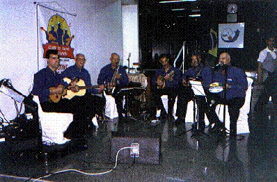
The perfomance of the Chorinho Group during the cocktail.
|
|
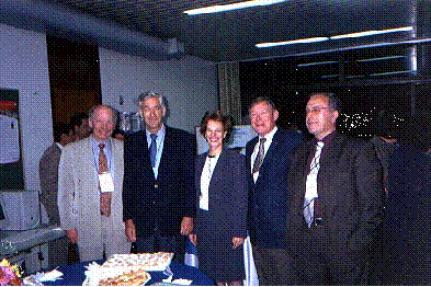
The ISPRS Council Members in the Welcoming Cocktail.
(From left to right: Dr. Ian Dowman, Dr. John Trinder, Dr. Tania M. Sausen,
Dr. Lawrence Fritz and Dr. Orhan Altan)
|
|
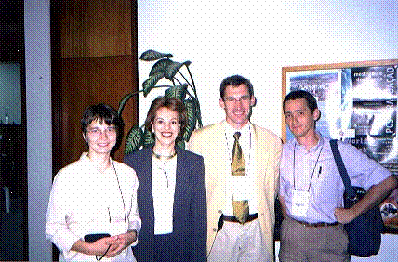
The ISPRS Commission 6 members and a symposium participant of French Guiana
(From left to right: Dr. Jana Niederoest, Dr. Tania M. Sausen, Dr. Pierre
Grussenmeyer and Dr. Laurent Polidori)
6. SYMPOSIUM FINAL REMARKS
·
Since the beginning of the
organization of this symposium, the main concern was somehow to join experts
from all around the world, representing a concentration of knowledge and experience
in education and communication in Commission 6 issues, and this goal was reached;
·
During the three days all participants
have the opportunity to attend several presentations about papers focused
on education and communication in photogrammetry, remote sensing and spatial
information systems. All these presentations and papers represented a worthwhile
collection of information about new methodologies, technologies and opportunities,
accessible worldwide.
·
To organize a symposium like
this it is not an easy task, mainly if we consider the enormous difficulties
the organizing committee has faced to get financial support, in this special
moment in the Brazilian economy and politic transition. Despite these difficulties,
the committee always had the unconditional support from the symposium organizers
and sponsor.
|
|
The closing ceremony.
(Dr. John Trinder, the ISPRS President,
Dr. Tania M. Sausen, the ISPRS Commission 6 President, Dr. Walter Humberto
S. Piña, the representative of the SBC President, Dr. Gilberto Câmara Neto,
the representative of the INPE Director and Dr. Orhan Altan, the ISPRS Congress
Director)
|
|
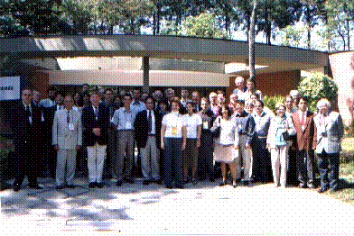
The participants of the ISPRS Commission 6 Mid Term Symposium
New Approaches for Education and Communication
7.
ACKNOWLEDGEMENTS
The
Symposium Coordinator would like to thank:
Technical Coordination
João Ávila, INPE, Brazil
Isabel Cristina Veja, IAI, Brazil
Lélio Ribeiro de Sá, ENCOM, Brazil
Secretariat
Tânia Regina Freire Sanchez, INPE, Brazil
Lígia Maria Fores Abrahão, FUNCATE, Brazil
Mônica Aparecida de Oliveira, INPE, Brazil
Web design and
Computer Assistance
Wellington Rodolfo Castilho de Almeida, INPE, Brazil
Ana Paula de Siqueira Corrêa, INPE, Brazil
Social Event
Egidia Ignácio da Rosa, INPE, Brazil
Scientific Committee
Emmanuel P. Baltsavias, ETH Zurich, Switzerland
Mark R. Shortis, University of Melbourne, Australia
Ulrike K. Rivett, University of Cape Town, South Africa
Sanjay Kumar, Centre
for Spatial Database Management and Solutions, India
Theodores Bouloucos, ITC, The Netherlands
Pierre Grussenmeyer, ENSAIS-Polytechnicum of Strasbourg, France
Tamara Bellone, Politecnico di Torino, Italy
Carlos G. Patillo, Pontificia Universidad Católica/CPR&SIG, Chile
Antônio Roberto Formaggio, INPE, Brazil
Hans Peter Baehr, University of Karlsruhe, Germany
Antônio M. G. Tommaselli, UNESP, Brazil
Basanta Shrestha, ICIMOD, Nepal
Heinz Ruther, University of Cape Town, South Africa
Mojca Fras, Institute of Geodesy, Cartography and Photogrammetry,
Slovenia
Gottfried Konecny, University of Hannover, Germany
William Cartwright, RMIT University, Australia
Shannon R. Kaya, Canada Center for Remote Sensing,
Canada
Nadhir Al-Ansari, Al-al Bayt University/UN Regional Center, Jordan
Walter Humberto Subiza Piña,
SBC, Brazil
Alexandre Benevento Marques,
SBC, Brazil
These
three days Symposium were really meaningful for all participants and for ISPRS
Commission 6, because we stepped to the future on education and communication
in phogrammetry, remote sensing and spatial information systems; we started
our journey into the new millennium, but most of all we met colleagues and
made friends, that together will care about improving and making available
the education and communication to all society.
In
this Symposium, Commission 6 could show that it is possible to do important
and useful activities in education all over the world. We just need motivation,
dedication, support from main institutions involved with this subject and
mainly courage to face the new challenges.
| Back | Home |